


NewTechBio Lake & Pond Planning Tool
Lake and Pond Size Calculator
Estimate lake or pond surface acres, acre-feet, gallons, average depth and shoreline perimeter. Draw the waterbody on a live map or enter manual measurements before planning treatment, dye, aeration, maintenance or a NewTechBio support request.
- Planning estimates for ponds, lakes, lagoons, stormwater ponds and retention basins
- Built for homeowners, applicators, HOAs, golf courses, municipalities and commercial sites
- Need help sizing a waterbody? Call 800-509-0927

Interactive Calculator
Calculate lake and pond acres, acre-feet, gallons and perimeter
Start with the live map when you do not know exact dimensions. Use manual tabs when you have length, width, diameter, known acreage, field measurements or section measurements.
Live Map Measurement
Draw your lake or pond on the map
Search for the property, switch to satellite view if needed, click around the shoreline, then close the shape. The calculator estimates surface acres, shoreline perimeter, acre-feet and gallons when average depth is entered.
Map not loaded yet.
- Search the site or zoom to the waterbody.
- Click around the shoreline to add points. Keep points close together on curves.
- Drag points to refine the outline. Use undo or clear when needed.
- Enter average depth only if you need acre-feet or gallons.
Rectangle or square pond calculator
Best for ponds, lagoons, basins and treatment areas that can be measured by length and width.
Round pond calculator
Use this for circular ponds, tanks, basins or treatment areas measured by diameter.
Triangular pond or section calculator
Use this for triangular ponds, wedge-shaped coves, corner basins or one section of an irregular pond.
Oval pond calculator
Use this for oval, oblong or rounded natural ponds where a rectangle would overstate the surface area.
Known acreage plus average depth
Use this when you already know the pond surface acres. Fraction inputs such as 0.25, 1/4, 1 1/2 and 12.18 are accepted.
Irregular pond by sections calculator
Divide an odd-shaped pond into rectangles, round areas, triangles, ovals or known-acre sections. The calculator totals the surface area and uses a weighted average depth.
| Shape | Measure A | Measure B | Unit | Avg. depth | Depth unit | Remove |
|---|
Average depth calculator
Average depth is the most important volume input. Use several depth readings when possible.
Pond measurement unit converter
Convert common field measurements before using the pond calculator.
How It Works
Use the measurement method that fits your waterbody
A lake or pond’s surface acres measure the top area of the water. Acre-feet measure water volume. Many aquatic treatment, dye, aeration and maintenance decisions use one or both values, so this tool gives square feet, surface acres, shoreline perimeter, acre-feet, cubic feet and gallons from the same workflow.
- Draw on the map or enter measurements. Use the live map for irregular waterbodies, or use the manual calculator for known shapes and acreage.
- Enter average depth. Use multiple depth readings when possible. Average depth is not the deepest point.
- Review results. Copy or print the result for treatment planning, support requests, internal records or board review.
Quick definitions
- Surface acre
- One acre of water surface equals 43,560 square feet.
- Acre-foot
- One surface acre of water at one foot deep.
- Average depth
- The typical depth across the waterbody, estimated from multiple readings.
- Shoreline perimeter
- The distance around the traced water edge, useful for shoreline and cove planning.

Formula Reference
Lake and pond size formulas used by this calculator
The calculator keeps the math visible so users can understand the estimate and professional users can verify the output.
| Calculation | Formula |
|---|---|
| Map polygon surface area | Calculated from the closed path, converted from square meters to square feet and acres |
| Rectangle surface area | length × width |
| Round surface area | π × radius² |
| Triangle surface area | base × height ÷ 2 |
| Oval surface area | π × (length ÷ 2) × (width ÷ 2) |
| Surface acres | surface square feet ÷ 43,560 |
| Acre-feet | surface acres × average depth in feet |
| Cubic feet | surface square feet × average depth in feet |
| Gallons | cubic feet × 7.480519 |
| Gallons per acre-foot | approximately 325,851 gallons |
Formula constants are aligned with standard pond measurement references, including 43,560 square feet per acre and approximately 325,851 gallons per acre-foot.
Average Depth
How to measure average pond depth
Average depth drives acre-feet and gallons. A pond with the same surface acreage can hold very different water volume depending on bottom shape, shallow shelves, coves, sediment and deep zones.
- Take depth readings across shallow, middle and deeper areas.
- Use a weighted average or split the waterbody into sections when depth varies sharply.
- Do not use the maximum depth as the average depth unless the entire waterbody is close to that depth.
- For safety, measure from a stable boat, dock or shoreline with appropriate supervision.

Irregular Ponds
How to estimate an odd-shaped pond or lake
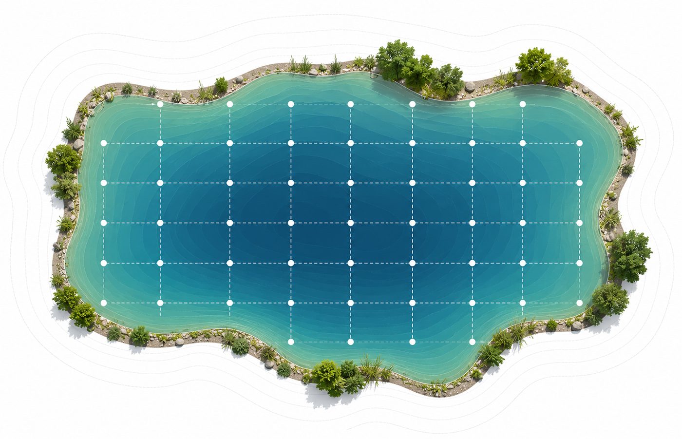
Natural ponds rarely match a perfect rectangle or circle. Use the map tool for the best user experience. Use section measurements when satellite view is blocked, water levels are unusual or only part of the waterbody is being treated.
- Draw the shoreline on the live map, or sketch the pond from above.
- Divide the surface into rectangles, triangles, ovals, round sections or known-acre areas.
- Measure average depth for each section if depths are different.
- Total the area and volume, then document any problem zones such as coves, docks, beaches, inflows or outflows.
Managed Waterbodies
Retention ponds, stormwater ponds, lagoons and commercial basins
This calculator can estimate existing surface area, shoreline perimeter, acre-feet and gallons for retention ponds, detention basins, stormwater ponds, lagoons, HOA lakes, golf course ponds and facility waterbodies. It is not a civil engineering design calculator for required stormwater storage, peak runoff, detention routing or permit compliance.
- Use it for maintenance planning, biological treatment planning and support conversations.
- Use a qualified engineer for new basin design, permit-sensitive storage calculations and regulatory submittals.
- Keep measurement reports for board, procurement, facility or environmental records when appropriate.
Note
For regulated sites, align calculator outputs with the site management plan, product label, permits, BMPs, monitoring requirements and internal environmental, health and safety policies.
Treatment Planning
What your lake or pond calculator results can help with
Accurate size estimates help reduce guesswork before selecting treatment products, preparing a support request or discussing a site with a pond professional.
- Surface acres: useful when product planning is based on water surface area.
- Acre-feet: useful when treatment, dye or aquatic planning depends on water volume.
- Gallons: useful for small ponds, tanks, basins and general volume understanding.
- Perimeter and sections: useful for coves, shorelines, partial treatments and problem-zone planning.
Before using results for treatment
This calculator does not replace product labels, aquatic herbicide or algaecide directions, permits, professional site review, water testing or survey data. Use it as a planning tool, then confirm the correct application basis for the specific product and site.
View lake and pond productsExamples
Common lake and pond calculation examples
Fraction-acre pond
0.25 acres × 9 ft average depth = 2.25 acre-feet
2.25 acre-feet × 325,851.43 = about 733,166 gallons.
Known acreage lake
12.18 acres × 4 ft average depth = 48.72 acre-feet
48.72 acre-feet = about 15,875,482 gallons.
Rectangle pond
300 ft × 200 ft = 60,000 sq ft
60,000 sq ft = 1.38 acres. At 6 ft average depth, that is about 8.26 acre-feet or 2,692,987 gallons.
Triangular pond section
300 ft base × 500 ft height ÷ 2 = 75,000 sq ft
75,000 sq ft = 1.72 acres. At 4 ft average depth, that is about 6.89 acre-feet or 2,244,156 gallons.
Accuracy
Common pond measurement mistakes
Using maximum depth
The deepest point usually overstates pond volume. Use average depth or multiple section depths.
Forgetting unit conversion
Yards, inches and meters must be converted before acreage, acre-feet and gallons are calculated.
Confusing acres and acre-feet
Acres are surface area. Acre-feet are volume. A one-acre pond at four feet average depth is four acre-feet.
Oversimplifying irregular ponds
Large coves, islands, shallow shelves and separated basins should be measured on the map or as sections when possible.
FAQ
Lake and pond size calculator questions
How do I calculate pond acreage?
For a rectangular pond, multiply length by width in feet, then divide by 43,560. For an irregular pond, use the map tool or divide the pond into smaller shapes and add the areas together.
How do I measure a pond or lake on a map?
Search the location, switch to satellite view if helpful, click around the shoreline to create a polygon, then close the shape. The calculator converts the mapped area to square feet, surface acres and perimeter.
What is the difference between acres and acre-feet?
Acres describe the surface area of the water. Acre-feet describe volume. A pond that is 1 surface acre and 3 feet deep on average contains 3 acre-feet of water.
How many gallons are in one acre-foot?
One acre-foot is about 325,851 gallons. The calculator also uses cubic feet multiplied by 7.480519 to generate gallon estimates.
Can I enter 0.25 acres or 1/4 acre?
Yes. The known-acreage calculator accepts decimal acres and common fractions such as 0.25, 1/4 and 1 1/2.
Can this calculator tell me exactly how much pond treatment to use?
No. It provides size and planning estimates. Treatment quantities depend on product type, label directions, active ingredient, water conditions, target issue, restrictions and application strategy.
Should I calculate the whole pond or only the problem area?
That depends on the product and treatment objective. For planning, calculate the whole waterbody and any priority areas such as coves, beaches, docks, shorelines, inflows or stagnant zones.
Need Site-Specific Help?
Send your lake or pond measurements to NewTechBio support
Copy your calculator results and include photos, symptoms, waterbody use, aeration status, product history and the target area you want to improve.